When a dam bursts: How to mitigate risks
Access to early warning systems and timely information is key to minimising the adverse impacts of floods. Early warning together with information identifying at-risk areas will also improve the efficiency of the response
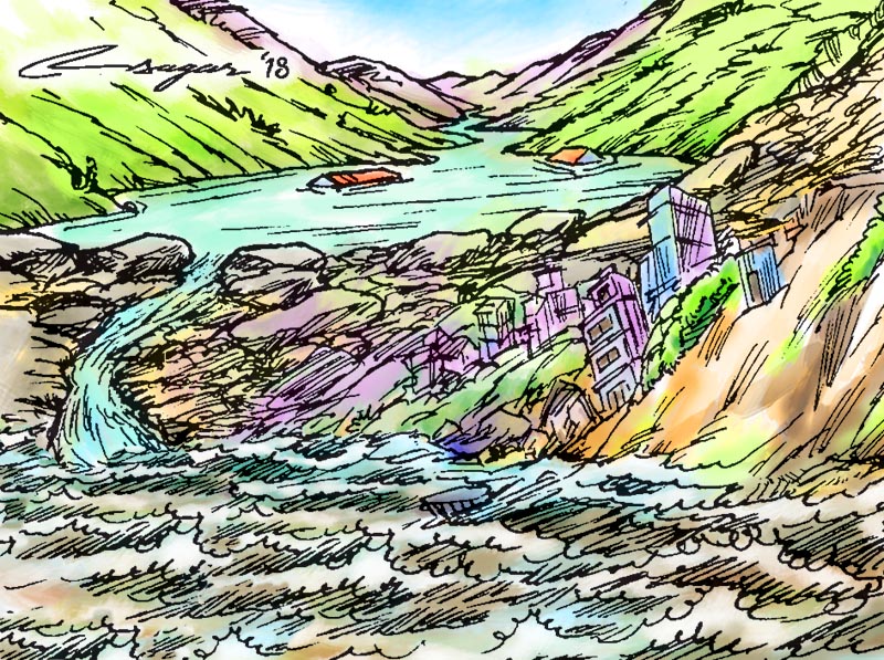
When the Sepien-Senamnoi Hydropower Reservoir in Lao PDR burst on July 23, the resultant flood left more than 40 dead, 90 missing, and thousands homeless. These floods were a cruel reminder of the threats we face from potential dam bursts. Glacial lakes, created as a result of melting glaciers, also pose similar risks.
Glacial lake outburst floods (GLOFs) can cause considerable damage to life and property. Since 1935, over 20 GLOFs have impacted river courses and floodplains in Nepal. The most recent GLOF originated in the Tibet Autonomous Region of China in July 2016, bringing down large volumes of debris and discharge to the Bhote Koshi River which swept away 20 concrete houses and put 200 houses at high risk. Large boulders that were swept down by the floodwaters destroyed the headworks of the 45MW Bhote Koshi Hydropower Project, which has yet to resume operations.
Nepal’s mid-hill region with its steep unstable slopes, complex topography, and weak geological formation is prone to numerous geo-hazards such as landslides and earthquakes which could contribute towards the formation and outbursts of natural dams. The 2015 Gorkha Earthquake and its aftershocks triggered more than 4,000 landslides, many of which blocked steep river valleys creating lakes on the Marsyangdi and Kali Gandaki rivers. Luckily, in both cases, the rivers drained through the debris and there was no significant damage downstream.
Another example is the Jure landslide of August 2014 in Sindhupalchowk district, which formed a natural dam across the Sunkoshi River.
According to a report of the Ministry of Irrigation, this created a lake with over eight million cubic metres of water, or approximately twice the size of Rupa Lake, putting large populations downstream at risk of floods. Fortunately, timely measures were taken to drain the lake and there were no human casualties due to flooding.
In recent years, increasingly erratic and unpredictable monsoon rainfall patterns and increased climate variability have led to severe and frequent flood disasters in Nepal, which has adversely impacted lives, livelihoods, agricultural productivity, and hydropower production. The 2017 floods alone took more than 160 lives, affected over a million more, and damaged crops worth Rs 8.1 billion. Haphazard urbanisation and construction in river basins have also increased exposure to risks, as was seen during the flooding of Hanumante River in Bhaktapur this year.
The Lao PDR government had a four-year programme (up to 2020) aiming to reduce the impacts of flooding and to enhance hydro-meteorological services. Despite having standard operating procedures for floods, little or no warning was provided to the people living downstream when the dam suddenly failed in July. The warning issued by Xe-Pian Xe-Namnoy Power Company, which operated the dam, also did not reach the downstream communities on time.
Timely flood preparedness is key to saving lives and property.
Nepal’s Department of Hydrology and Meteorology has been providing flood advisories with information on rainfall estimates, weather forecasts, updates on the situation of major rivers since 2016. These advisories are issued as flood bulletins and SMS alerts to targeted recipients that include key organisations involved in disaster risk reduction, including the National Emergency Operating Centre and individuals within the identified hazard zones. During the 2017 floods, such large-scale SMS alerts were sent to more than a million people and contributed to saving many lives.
The Disaster Risk Reduction Act, approved by the Cabinet in 2017, has empowered local authorities to carry out disaster risk reduction at the local level. Under the new federal structure and governance system, Nepal now has to strengthen its disaster management systems at the central, provincial and local levels, to improve understanding of disaster risk and management. The ongoing drafting of guidance documents, working procedures, and fund allocations for disaster risk reduction, is a good start.
Access to early warning systems (EWS) and timely information is key to minimising the adverse impacts of floods. Early warning together with information identifying at-risk areas will also improve the efficiency of the response. All this can be, however, achieved only with a wider partnership in place and a greater devolution of disaster management roles and responsibilities to local governments.
A recent study by ICIMOD which looked at EWS indicates that action needs to take place at the local level. Early warning information has to reach individuals and households through formal and informal institutional mechanisms. It is also necessary for the community to understand the implications of the warnings and to be trained to take appropriate action, identify safe evacuation routes, and establish safe zones in advance.
Lastly, as we develop our hydropower rapidly, it is necessary to design robust infrastructure and have early warning systems in place to warn communities living in high risk areas. If we do this, we can avoid disaster at the scale Lao PDR unfortunately had to face.
Shrestha is coordinator for River Basins and Cryosphere Programme at ICIMOD


