Cities "woefully unprepared" for rising disaster risk
LONDON: Cities around the world are failing to plan for fast-increasing risks from extreme weather and other hazards, particularly as population growth and surging migration put more people in the path of those threats, the World Bank said on Monday.
By 2050, 1.3 billion people and $158 trillion in assets will be menaced by worsening river and coastal floods alone, warned a new report from the Global Facility for Disaster Reduction and Recovery (GFDRR), managed by the World Bank.
"Cities and coastal areas are woefully unprepared for the kind of climate and disaster risk now facing our world," said John Roome, the World Bank Group's senior director for climate change.
But as cities expand and revamp, they have the opportunity to lower that risk by putting in place more resilient infrastructure and preventive policies, he said.
Those could include everything from restrictions on using too much groundwater - one of the reasons cities from Tokyo to Jakarta are sinking - to planning for more green space, and new schools and apartments set above flood-prone zones.
The problem is that many city officials have no clear idea of the range of disaster risks they face and how serious they could be. Argentina, for instance, has no volcanoes but is affected at times by ash from eruptions in Chile.
And when Malawi was hit by an earthquake in 2009, it came as a surprise. "Not many people think about the African continent and its potential for earthquakes," said Alanna Simpson, a risk management specialist with the GFDRR.
NO PHD? HELP AT HAND
A new open-source disaster risk management tool, called ThinkHazard!, aims to make planning for such threats easier by pulling together information on all potential disaster risks in a country or region, and how they compare.
It looks at hazards including floods, cyclones, droughts, heat waves, fires, earthquakes, tsunamis, volcanic eruptions and landslides.
The tool, aimed at national and city planners, project developers and others, also offers advice on what might work to reduce the risks.
While information on disaster risks already exists, it tends to be in scattered locations and jargon-heavy language, Simpson said.
For an average planner, "you need a PhD to understand if a country has risk and how it might affect your project", she told the Thomson Reuters Foundation.
The new tool, developed by the GFDRR, brings the information together and simplifies it, so that the developer of a road or school in Kenya, for instance, can get a sense of the level of risks their project faces - including threats they may not know about.
Those can be substantial, the disaster experts noted. In Indonesia, the risk of flooding from overflowing rivers is expected to grow 166 per cent over the next 30 years, while coastal flooding risk could rise 445 per cent, the report said.
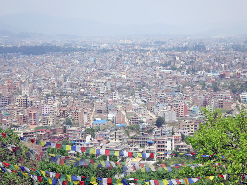
Nepal's capital Kathmandu is expected to see a 50 per cent rise in earthquake risk by 2045 as more slums and informal buildings go up.
A combination of sea-level rise and sinking of coastal cities - including from excessive extraction of the groundwater beneath them - could drive disaster losses in 136 coastal cities from $6 billion a year in 2010 to $1 trillion a year by 2070, the report said.
But planning now for more big typhoons in Manila, for example, by ensuring new homes are not built on flood plains and keeping drainage canals clear, will pay off, the experts said.
"The decisions we make today are defining the disasters of tomorrow," said Francis Ghesquiere, head of the GFDRR secretariat.
"We have a huge challenge - but also a huge opportunity - to try to make sure the trillions of dollars that will go into new housing, new infrastructure, the extension of cities... do not increase risk exposure but rather reduce it."
READ ALSO: Nepal third in internal displacement by natural disasters


