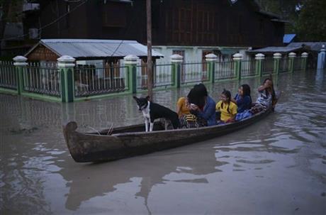
Myanmar floods move downriver, risking more populated areas
YANGON: Waters from badly flooded central and northern Myanmar were flowing down rivers to more populated areas, risking new devastation, relief officials warned Tuesday.
The UN Office for the Coordination of Humanitarian Affairs said water levels have receded in the main town in hard-hit Sagaing division in the northwest but the floods are likely to expand into additional areas.
Several towns in the Irrawaddy Delta, which is Myanmar's main rice-growing region, have reportedly been flooded since Monday. The delta region was largely swamped in 2008 by Cyclone Nargis, which took about 140,000 lives.
Officials say the death toll from the recent weeks of almost continuous rain is 46, with more than 200,000 people affected by flooding in 11 of the country's 14 states and divisions.
Concern remained high in coastal Rakhine state, where more than 130,000 people displaced by ethnic conflict live in badly built and poorly located camps. The damage done by monsoon rains was multiplied by the effects of a cyclone last week.
"Across the affected areas, transportation, electricity and communication are disrupted," the U.N. agency said. Access is a challenge, with floodwaters and landslides blocking roads and with the debris floating in rivers posing risks to boats.
It also noted that losses of stored grain and livestock were expected to disrupt the planting season and endanger long-term food security.
The Myanmar's Department of Meteorology upgraded flood warnings for downriver sections of the Irrawaddy River — also called the Ayeyarwaddy — from yellow status — "be alert" — to orange — "be prepared" to move.
Schools were closed in Nyaungdon, a major riverine town slightly northwest of Yangon, and people moved to higher ground as the river rose. Several dams are holding back swollen waters as well, adding to the threat.


