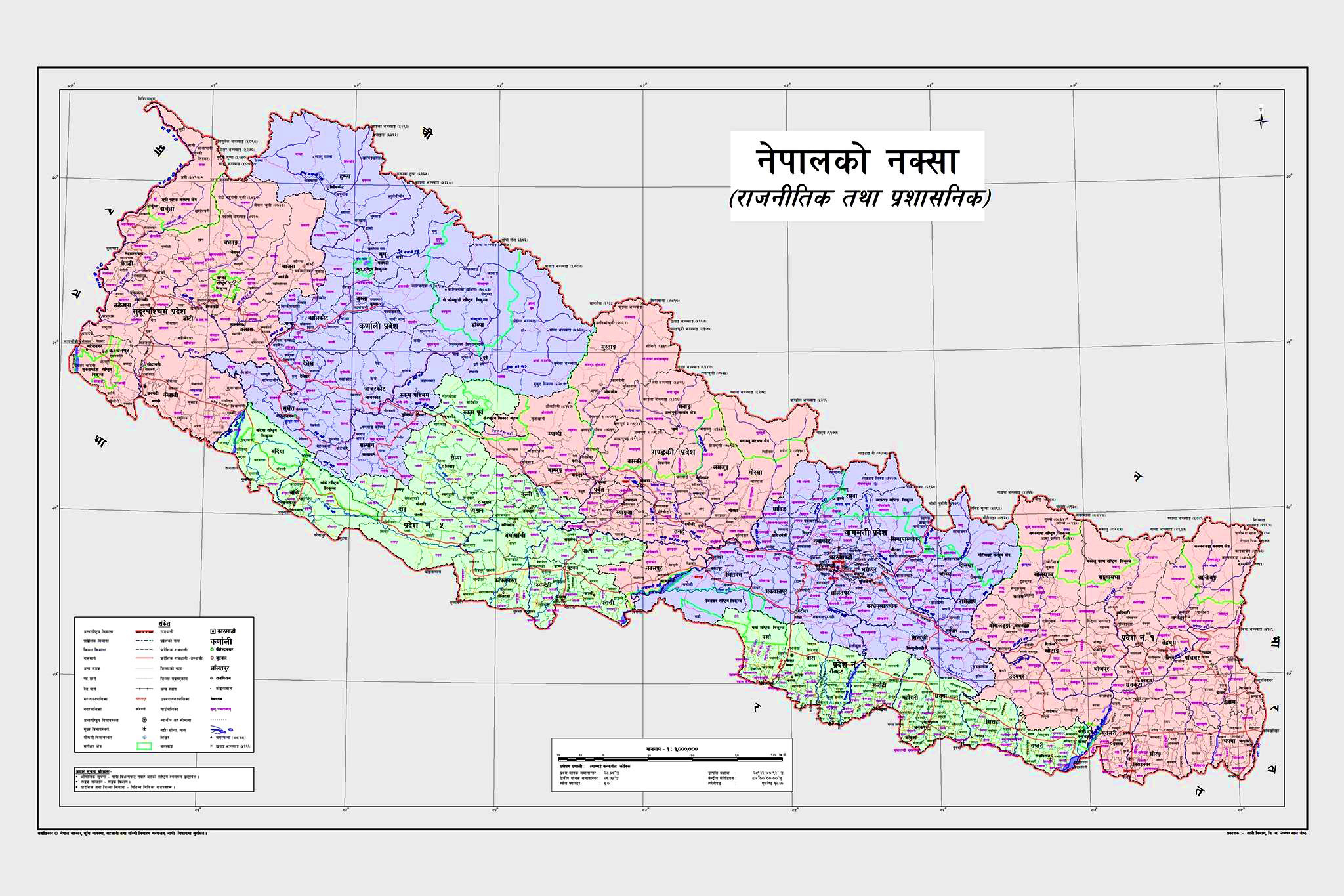
Govt officially unveils new political map incorporating Limpiyadhura, Lipulekh, Kalapani
KATHMANDU: The Government of Nepal, in a follow-up of its recent decision to endorse the issuance of a new political map incorporating Limpiyadhura, Lipulekh and Kalapani, has officially unveiled the map today.
Ministry of Land Management, Cooperatives and Poverty Alleviation had presented the new geographical map of Nepal comprising the disputed lands at Singha Durbar. Minister Padma Kumari Aryal officially announced the release of the map to public on the national broadcasting channel Nepal Television.
Prime Minister KP Sharma Oli's Chief Advisor Bishnu Rimal took to Twitter to share the news of official issuance of the map prepared by the Ministry of Land Management.
The new political map was tabled for approval in the cabinet meeting held on May 18, which had ended with endorsement of the issuance of the map.
President Bidya Devi Bhandari and Prime Minister KP Sharma Oli, both, had recently made official announcements at the Federal Parliament regarding the unveiling of the new geographical representation of the country incorporating the territories encroached by India.
The Government of India had unilaterally inaugurated a link road to Mansarovar in Tibet of China via Nepali territory, which had refuelled tensions between the two neighbouring countries, leading to a statement war of sorts.
In addition to its official release, the Ministry is yet to bring its coat of arms and logo into use as per the updated map, for which, it is preparing to present a bill in the parliament, seeking an amendment to the constitution's index.
READ ALSO:


