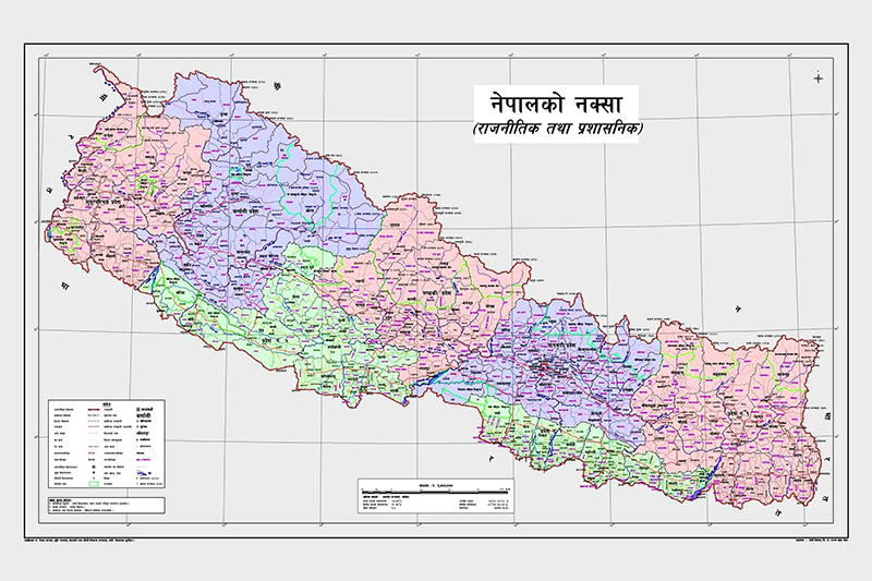
Nepal issues new political map, claiming disputed territory its own
- India tells its northern neighbour to refrain from ‘unjustified cartographic assertion’
- Calls it ‘artificial expansion’
Kathmandu, May 20
Minister of Land Management, Cooperatives and Poverty Alleviation Padma Kumari Aryal today issued Nepal’s new political and administrative map depicting Limpiyadhura, Lipulekh and Kalapani areas as Nepal’s territory. India, however, has political and administrative control over these areas and claims them to be its part.
After issuing the map at the Ministry of Land Management, Cooperatives and Poverty Alleviation today, Aryal said the occasion marked a milestone in the glorious history of the country. “Today is the happiest day for this generation of Nepalis,” she said, adding that the issuance of the new political and administrative map would boost the morale of all Nepalis. The government will soon put the new map on the government website, use it in all offices and incorporate it in school textbooks.
The MoLMCPA issued the map a day after Prime Minister KP Sharma Oli told the House of Representatives that the government would reclaim Limpiyadhura, Lipulekh and Kalapani.
Stating that the three areas that lay east of the Kali (Mahakali) River were Nepali territory as per the 1816 Sugauli Treaty, the minister said the government was glad that the border issue had united the entire country.
Aryal said that the government’s decision to issue the new map was a testimony of the fact that it was capable of defending the sovereignty of the country.
She hoped that India would take the issuance of the new political and administrative map of Nepal positively, adding that the government would seek diplomatic solution to the border dispute with India.
Last week, India had inaugurated a link road from Pithoragarh in Uttarakhand to Kailash Mansarovar in Tibet Autonomous Region of China via Lipulekh. Nepal’s Ministry of Foreign Affairs issued a press statement objecting to the inauguration of the link road and also handed over a diplomatic note to India’s Ambassador to Nepal Vinay Mohan Kwatra to protest the inauguration of the link road.
The Indian Ministry of External Affairs, meanwhile, has objected to the issuance of political and administrative map by Nepal, saying the map included Indian territory and such ‘artificial enlargement of territorial claims would not be accepted by India’.
Spokesperson for the Indian Ministry of External Affairs Anurag Srivastava said, “The Government of Nepal has released a revised official map of Nepal today that includes parts of Indian territory. This unilateral act is not based on historical facts and evidence. It is contrary to the bilateral understanding to resolve the outstanding boundary issues through diplomatic dialogue. Such artificial enlargement of territorial claims will not be accepted by India.”
“Nepal is well aware of India’s consistent position on this matter and we urge the Government of Nepal to refrain from such unjustified cartographic assertion and respect India’s sovereignty and territorial integrity,” Srivastava added.
He said, “We hope that the Nepalese leadership will create a positive atmosphere for diplomatic dialogue to resolve the outstanding boundary issues.”
A version of this article appears in e-paper on May 21, 2020, of The Himalayan Times.


